
What Are Drones and UAVs?
An unmanned aerial vehicle or uncrewed aerial vehicle (UAV), also known as a drone, is an aircraft that is completely machine operated without a human pilot, crew, or passengers on board. UAVs are a component of the more extensive unmanned aircraft system, including a ground-based controller and a method of communications with the UAV.
What is an Embedded Vision System?
Embedded vision systems are small parts of larger operating systems that perform one or two specific tasks. They’re based on microcontrollers or microprocessors and are already widely used by ordinary people every day. Traffic signals, digital watches, and drones all use embedded vision systems.
Keep reading to learn why UAVs and embedded vision technology are used in road maintenance, how they’re used in road maintenance, and some predictions for the future.
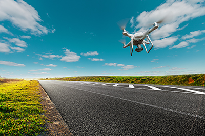
Why UAVs & Embedded Vision are Used for Road Inspection
Finding all kinds of road damage, both big and small, is a crucial and challenging task for road maintenance professionals. Even the most minor cracks and potholes can cause significant damage to vehicles. But more importantly, road damage can also cause safety hazards, accidents, and potential harm to commuters. Unfortunately, these hazards only get worse the longer they are ignored. But, with so much area to survey, it’s nearly impossible for road maintenance to catch every piece of damage before a commuter comes in contact with it. This is where drones and UAVs come in. These technologies can scan roadways faster than human crews and can do so at odd hours like night and early morning.
Additionally, inspection done by road crews rather than drones can at times lead to error. A road crew member’s decisions depend on their experience and their ability to see the roadway, which can be more difficult at night. However, drones and UAVs with embedded vision cameras and well-defined parameters can report a road area needing repair with great accuracy. Road maintenance professionals use UAVs and drones because they allow them to survey more roads, fix more damage, and prevent more accidents without having to hire multiple human-lead teams to do so.
How UAVs & Embedded Vision are Used to Inspect Roads
The specific type of embedded vision system used in drones to inspect roads is called stereo vision, and it examines roads by first being mounted on a drone and flown over the road to capture images. A PC and graphics card are used to process those images. Thousands of reference images and target images are then compared to synthesized and actual sets of potholes, cracks, and other road damages.
The embedded vision system then produces an algorithm that extracts 3D depth information from the images and captures a reference view. The system uses the differences between the reference image and real-time imaging to create a disparity map. That map is then fed into a scientific equation that highlights damaged areas on the road, like potholes.
Possibilities for the Future
Down the road, researchers hope to use the data obtained from embedded vision disparity maps to predict a road maintenance drone’s flight trajectory and reconstruct 3D maps using simultaneous localization and mapping (SLAM) algorithms. This algorithm will allow a drone or UAV to map out and survey new and unknown environments.
In addition to road maintenance, drones are being used in other maintenance projects and in natural disaster zones. Police departments and fire departments across the U.S. are also testings drones’ and UAV’s efficacy in assisting first responders.
Ready to find the right camera for your embedded vision project? Browse our broad selection of cameras from today’s leading manufacturers.